AQA Geography Section C: Physical Environments in the UK - UK LANDSCAPES
The UK's Physical Landscape
In this unit, you will study the following:Key Idea: The UK has a range of diverse landscapes.
Overview of the location of major upland/lowland areas and river systems.
Key Vocabulary
• landscape
• relief
• geology
• resistant
• river system
• atlas
• spot height
• cross-section
After working through this spread, most students should be able to:
• identify features and patterns on an atlas map
• appreciate the varied relief, landscapes and river systems of the UK
• explain how relief is determined by rock type
• understand that landscape is the result of interaction between natural and human factors
• describe the course of a river from a map
• draw a cross-section using spot heights
--------------------------------------------------------------------------------------------------

CW Date: 9B1 28th February 2019
(Slide Pres Alternative) What is the Landscape of the UK Like?
Page 90/91 of course text.
Entry Activity:
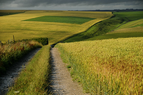
Would you consider this to be a typical view in the UK? (Why/why not?)
Key Term:
Compare - To note the similarity or differences between two or more things.
Contrast - To be strikingly different to something else.
Landscape - A view or aspect comprising a combination of specific features.
Relief - The "shape of the land" as defined by its height and steepness.
Read section 1 of pp 90... or below...
Activities
1 Read pp 90 of the GCSE core text.
2 Define the two key terms:
a. Relief
b. Landscape
Landscape - A view or aspect comprising a combination of specific features.
Relief - The "shape of the land" as defined by its height and steepness.
3 Apply your definitions of Landscape and Relief by describing the image below...

Try it with this image...

4 Complete the missing word activity provided to compare two areas of the UK - HERE
Consider:
UK's Landscapes - Comparing the landscapes of different parts of the UK.
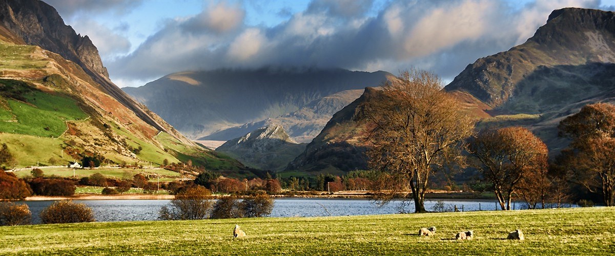
Look at the photos A and B in the text (pp 90)... they are clearly contrasting in a variety of ways.
To compare them, you need to use your general descriptive vocabulary... what words might be useful?
Also, you need to understand the appropriate geographical vocabulary... these are the tools of your subject communication e.g.
Landscape
Relief
Mountains
Hills
Valleys
Peaks and Precipices
Fields
Rural etc.
5 From your reading of the text, what is the main influence on the landscapes of the UK? Suggest why this is.

9R have done the location sheets (BOTH)... check next lesson and move on to activities from the text.
CW Date: 9E 27th February 2018
9R 5th March 2018
What is the Landscape of the UK Like?(continued)
Entry Activity
View the video: HERE
(NB show on new tab for better quality)
What do you think the defining feature is of the UK's landscape?
"The defining feature of the UK landscape is..." its diversity. This is to a large extent a product of Geology. This is the type of rocks under the ground. The geology affects rates of erosion and weathering. Areas of high relief are often formed from hard rock types whereas low relief is often associated with softer, more easily eroded rock types.
Highlight above to show
Feedback - Responses to entry activity.
Key Terms:
Location - Refers to where things are situated in space.
Diverse - showing a great deal of variety.
United Kingdom - The political union formed by the countries of England, Wales, Scotland and Northern Ireland.
Natural - not made or caused by mankind/humans.
In today's lesson we will continue the theme of the Diversity of the UK's Natural Landscape by looking at two specific areas.
Aims:
- To be able to geographically describe locations and landscapes.
- To be able to compare places.
- To build geographical knowledge of the UK.
Our chosen locations are...
Activity:
Complete the sheet provided to develop your comparative descriptive writing - HERE (Diff version pp2/3 - Y9)
Note: "location" is about where places are, so use your descriptive skills and geographical vocabulary to outline where each is within the UK.
Use the map on page 91 of the text to assist you and include geographical direction, countries, seas
etc.
When complete... go to pp 90 and attempt 1a, b, c, e and 2, 3a, 5:

Plenary:
- What countries make up the UK?
- What country is the Isle of Arran in?
- What country are the Cotswold Hills in?
- Which of the two above is most likely to have the toughest geology?
- Why?
CW Date: 9E 1st March 2018
9R 8th March 2018
9R to answer the following (plenary Qs from last lesson):
- What countries make up the UK?
- What country is the Isle of Arran in?
- What country are the Cotswold Hills in?
- Which of the two above is most likely to have the toughest geology?
- Why?
Title:
What is the effect of Geology on Landscapes?
Entry Activity:
Complete activities 1a, b, c, e and 2, 3a, 5 9R done, see alternative entry above.
Do Q 5 as a class activity... alphabet on the board and tick off as progress through... volunteers to answer!
Key Terms:
Resistance - Ability to withstand something. In rocks, this trait might be referred to as "HARDNESS".
Porous - Property of allowing water to soak in.
Granite - An IGNEOUS rock (Formed by fire inside the Earth)
Chalk - A SEDIMENTARY rock (Formed from the remains of tiny sea creatures)
Clay - A SEDIMENTARY rock (Often deposited by rivers/lakes.
Presentation (Effect of Geology) - HERE
Student sheet (to complete as go through the Presn) - HERE
Cloze activity - HERE
Activities:
1. Rock Types and their Effect on the Landscape - complete the A3 sheet provided as we go through the presentations. Work in pairs on this if it helps.
2. Complete the missing word activity using your learning from the presentation to assist you.
Also below:
The ………., and thus landscapes, are determined mainly by the …………... of an area. The underlying rocks form the landscape.
Tough, resistant rocks such as Granite are less easily ………….. and often form the high and rugged landscapes that we observe in places such as the ……………. Highlands or Wales and the Lake District. Such rocks also tend to be less ………………... (do not allow water to soak in easily). The effect of this is to trap water on the ………….. in lakes, rivers and, sometimes, bogs.
Soft rock like …….. is more …………. eroded and often forms…………….. and vales. Clay, though is also quite impermeable, so is likely to have plenty of surface drainage such as …………. and ………….. Examples of Clay vales include either side of the River ……… and near to Aylesbury.

Below is a view of the clay vale near to Box Hill in Surrey.

Chalk is quite a soft rock compared to Granite and other igneous rocks, but it is also tougher than Clay. So, where clay and chalk occur together, the chalk tends to form hills as it erodes more slowly than the clay. The hills tend to be rounded such as Box Hill or places like the Cotswold Hills in the South West of England.
Chalk is also permeable and thus allows water to soak in. As a result, Chalk landscapes tend to have fewer features of surface drainage. The absence of streams and rivers further reduces erosion contributing to their higher elevation compared to clay vales.
In this view of the Chiltern Hills in Buckinghamshire you can see the low-lying clay vale (to the left of the image) and also the exposed chalk on parts of the footpath.

Slide show about geology and landscape - HERE
Student sheet - PO as A3 - HERE
Forthcoming Learning Check and Assessment:
L. Ch - HERE
Asst - HERE
CW Date: 12th march 2018
UK's landscape - Main Features
Entry Activity:
Complete the multi-choice quiz provided (no books and no collaboration).
Check and feedback (Tally and record your scores). When you do this (or a similar test), you are aiming to improve (if possible) your score!
Key Terms:
UK - The political union of the countries of England, Scotland, Wales and Northern Ireland.
British Isles - The Geographic area of Britain including the countries of the UK plus The Republic of Ireland.
Country - A politically defined area sharing the same government/administration. Note that in the UK, we therefore have the confusing situation in which we have countries within a country! eg England in the UK...
Location - Where something is
Compass Direction - North, South East and West plus the intermediate directions such as North-East.
Activities:
The main part of today's session is devoted to developing and embedding your knowledge of key features of the UK and beginning to understand some of the relationships between these.
Using the map sources provided (Map source sheet - here)...
Part I
A. On the outline map below, circle and name the main areas of highland in the UK and the Seas that surround the British Isles. The first of each has been done for you....
B. Study the distribution of the highlands you have added to your map. Using compass directions, describe the patterns of distribution of the upland areas of the UK.
C. What does the pattern of High and Low land in the UK suggest about the Geology of the country?
Feedback... Check accuracy (correct or tick)
Now...
Part II... the main rivers in the UK
1. The UKs major Rivers are listed below right. Unscramble the names and add them to their correct locations on the map.
2. How many of the UKs rivers discharge into the North Sea.
3. In what direction then, do these rivers flow?
From Here NL
From Here NL
L. Ch - HERE
Asst - HERE
CW Date: 15th march 2018
Asst - HERE
CW Date: 15th march 2018
Title: Continuing work o
UK's landscape - Main Features
4. Which three rivers have their mouth in the English Channel?
5. Which river forms the boundary between England and Scotland?
6. The River Severn forms part of the boundary between two UK countries. Which ones?
Challenge:
Using geographical language and your understanding of landscapes in the UK, describe and explain the relationship between upland areas and drainage. Be sure to name places, features of the UK and use compass directions. If you are feeling really wizzy... refer to geology in your explanation.
Plenary:
- In what direction do most major rivers in the UK flow?
- Why is this?
Assessment and Admin...
1.
CW Date: 19th September 2017
UK's River Systems
Entry Activity:
Copy the following:
Copy the following:
UK's River Systems
The UK is rich in rivers... a consequence of climate, geology and relief.
Rivers in the UK (and elsewhere in the world) are closely linked with human activity... have you noticed how most major settlements are to be found near to large rivers?
Large rivers provide a plentiful source of water for big populations that need it for drinking, cooking, hygiene, industrial processes and transportation. The extended flood plains of rivers near to their sources also ensures that there is a lot of flat land to build on and to farm.
Feedback from marking.
Action:
Complete your river and highland map started last lesson.
UK Landscapes Multiple Choice - HERE
1. Study the UK Relief map on page 91.
2. Most rivers flow into the seas surrounding the UK. What types of landscapes do they tend to originate in though?
3. Why do you think that most rivers share these characteristics?

What terms are used to describe the beginning of a river and its end?
NL 20th September 2017 - Entry Task:
Action:
1. Describe and explain the relationship between relief and drainage patterns in the UK... give examples from the map of the UK to support your answer.
3. Write 5 questions about the landscape of the UK (you must know the answers) and test your partner.
--------------------------------------------------------------------------------------------------


No comments:
Post a Comment
Note: only a member of this blog may post a comment.